 One of the three National Parks of Yorkshire
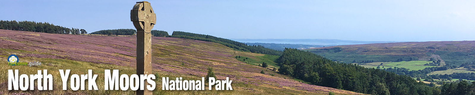
North York Moors National Park offers some amazing scenery across its wide expanse of heather moorland stretching to its dramatic
The National Park was created in November 1952, the sixth of ten established in England and Wales in the 1950s. It extends across an area of 554 square miles (1,435 square kilometres).
Within its area are historic stateley homes, remains of castles and abbeys, attractive villages and market towns and the longest of Yorkshire's
The National Park has also been designated an International Dark Sky Reserve by the International Dark-Sky Association, where stargazers can observe the night sky without the light pollution from towns and cities.
Villages in the National Park
With the exception of the market town of Wholly or partly within the National Park are the villages of:
Just outside the National Park are:
 Information
There are National Park Centres near Danby and at Sutton Bank. Further details about The Moors National Park Centre can be found at the  Danby Lodge National Park Centre
Danby Lodge National Park Centre• The Sutton Bank National Park Centre is situated off the
Further details about the Sutton Bank centre can be found at the Sutton Bank National Park Centre web page.
Sutton Bank National Park CentreThere are tourist information centres in Easingwold,
 Travel
The park is crossed by two railways. A Northern rail service runs from Middlesbrough to the edge of the National Park at Great Ayton and Battersby where it reverses to run along the Esk Valley line all the way to The National Park also starts around 1.5 miles away from the mainline
 A scenic 18-mile route across the park is run by the North York Moors Railway, which has steam trains hauling many of its services. Trains run from Pickering to the village of Goathland, a village made famous by ITV's Heartbeat series, then on to Grosmont, where trains now join the Esk Valley line to run to and from the station in Whitby, near to its beautiful fishing harbour. More on our
  Other websites
 North York Moors National Park The official website of the North York Moors National Park Authority.North York Moors Railway Steam railway running an 18-mile journey through the National Park.
 Also in Yorkshire.guide
Peak District Yorkshire Dales Places to visit Film locations